Purpose
This project comprises research works carried out in the metrology laboratories as well as in the natural environment. In the SoMMet project, three high-level test field sites will be used.
Each of the sites will be used for the following purposes:
- Development of validation practices for CRNS methodology in outdoor conditions
- Joint measurement campaigns using different methods of soil moisture assessment:
- point-scale soil moisture sensors
- CRNS neutron detectors
- data from remote sensing methods
- Comparison of soil moisture measurement methods, their constraints and different spatial and temporal characteristics
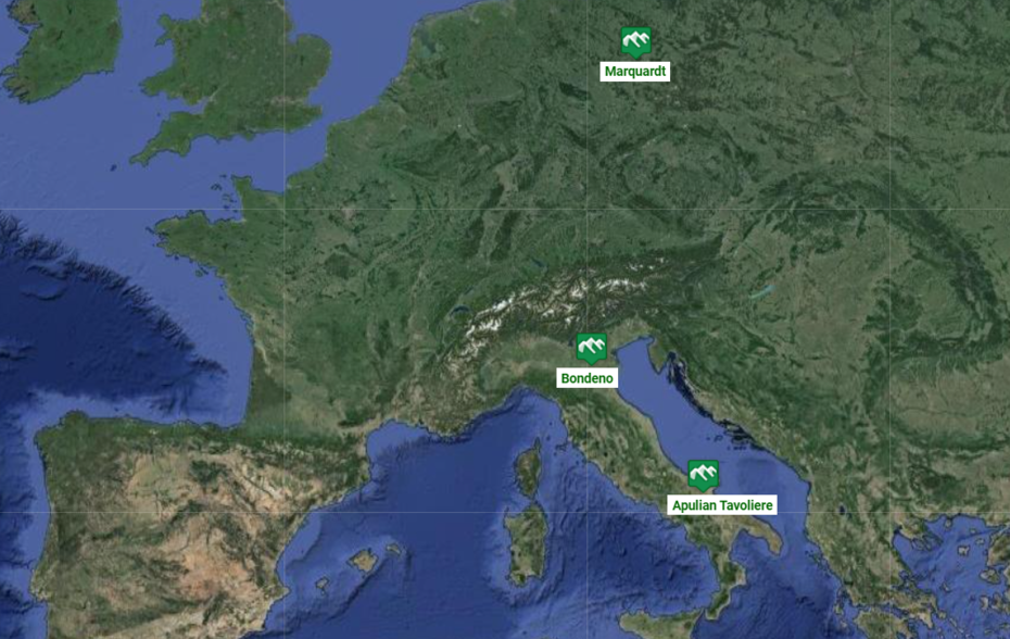
Sites of SoMMet
The following high-level test field sites were selected by the SoMMet Consortium:
(in alphabetical order)
Apulian Tavoliere
Organizing SoMMet partner: CNR
Region, Country: Apulia Region, Italy
Location (latitude-longitude of the centre): 41.460, 15.501
Land use: agricultural (tomato, durum wheat)
Further information:
Bondeno
Organizing SoMMet partner: UNIBO
Region, Country: Emilia-Romagna Region, Italy
Location (latitude-longitude of the centre): 44.8552, 11.3772
Land use: agricultural (walnut orchards)
Marquardt
Organizing SoMMet partner: UP DE
Site operator: Leibniz-Institut für Agrartechnik und Bioökonomie e.V. (ATB), Potsdam-Bornim
Region, Country: Potsdam, Brandenburg, Germany
Location (latitude-longitude of the centre): 52.466, 12.958
Land use: agricultural (crops, orchard, grass)
Further information: